
Fog advisory for Toronto and southern Ontario as visibility drops to near zero
Environment and Climate Change Canada has issued a yellow-level fog warning for Toronto and wide parts of southern Ontario, with visibility expected to fall to near zero in some areas.
Translated from Arabic. Read the original بالعربية
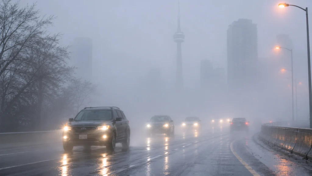
TORONTO — Environment and Climate Change Canada has issued a yellow-level weather warning because of dense fog in the City of Toronto and large parts of the Greater Toronto and Hamilton Area.
The agency warned that visibility could suddenly drop to near zero in some areas, which could make travel on roads hazardous.
The warning was renewed on Saturday afternoon after fog formed again near Lake Ontario. Conditions are expected to persist until late Sunday morning.
Dense fog has covered Toronto since the morning
Toronto residents woke up on Saturday morning to heavy fog that obscured the city's landmarks and sharply reduced visibility.
The weather agency issued its first warning at 3:45 a.m. local time and lifted it at about 11:30 a.m., after conditions improved.
However, fog formed again near Lake Ontario, prompting the agency to issue a new warning at 4:25 p.m.
Authorities classified the expected impact of the weather event as moderate, with high confidence in the forecast.
Wide areas covered by the warning
The morning warning was not limited to the City of Toronto. It covered many areas and cities in southern Ontario, including:
Mississauga, Brampton and Halton Region.
Markham, Vaughan and Richmond Hill.
Hamilton and Niagara Region.
Oshawa and Pickering.
Newmarket and northern York Region.
Kitchener, Cambridge and Waterloo.
Guelph and surrounding areas.
Weather alerts also extended to other parts of eastern and southwestern Ontario.
The density of the fog varies from one area to another, depending on humidity levels and local weather conditions.
Reduced visibility at Toronto Pearson airport
Weather observations at Toronto Pearson International Airport showed visibility down to 400 metres at 10 a.m.
The air temperature at the time was about 5 C, and humidity reached 97 per cent.
Dense fog can affect air navigation, particularly during takeoff and landing.
Travellers are advised to check the status of their flights before heading to the airport, in case of changes to flight times.
The issuing of the warning does not necessarily mean flights will be cancelled or operations at the airport will stop.
Warnings for drivers on highways
Environment and Climate Change Canada urged drivers to allow extra time to reach their destinations, as they may face difficult driving conditions.
Reduced visibility can make it hard to see vehicles, pedestrians and obstacles on the road.
The risks increase when a driver moves suddenly from an area with good visibility into one covered by dense fog.
The Ontario Ministry of Transportation recommends a number of precautions when driving in these conditions, chiefly:
Reduce speed to suit visibility.
Use low-beam headlights.
Turn on fog lights if available.
Increase the following distance between vehicles.
Avoid unnecessary passing.
Postpone non-essential trips when the fog thickens.
Drivers are also advised to stop in a safe place away from traffic if it becomes impossible to continue driving.
When will conditions improve in Toronto?
The latest Environment and Climate Change Canada forecast indicates the dense fog will lift late Sunday morning, Nov. 22.
Toronto is expected to see sunny skies once visibility improves, with the daytime high rising to 14 C.
Temperatures will fall to about 6 C on Sunday evening, with a 30 per cent chance of light rain.
On Monday, the high is expected to drop to 8 C, before falling to 4 C on Tuesday, with a chance of flurries.
The forecast points to a spell of colder weather arriving after the weekend.
Why does dense fog form?
Fog forms when moist air near the ground cools, causing water vapour to condense into tiny droplets suspended in the air.
High humidity and weak winds help the fog last longer.
Bodies of water such as Lake Ontario can also create conditions suitable for fog to form in neighbouring coastal areas.
Canadian authorities are urging residents to follow weather updates regularly, especially before travelling at night and in the early morning, when the chances of reduced visibility are greatest under current conditions.
More from Hala Canada
- One of Canada's most wanted arrested in connection with Toronto homicide
- Navdeep Bains elected leader of the Ontario Liberal Party
- Ottawa and Ontario announce $759.1 million in support for Ford amid trade war pressures
- Alberta issues 374 new invitations to workers under its immigration program
- Leaders and experts from more than 70 countries gather in Halifax for global security forum
- Canada to issue November CPP payments early, with maximum monthly benefit of $1,507.65