
Cold air, rain and possible snow headed for Toronto as temperatures fall to near zero
Toronto and the GTA face a sharp drop in temperatures this week, with rain, strong winds, possible light snow and frost starting Thursday, after an unusually warm start to November.
Translated from Arabic. Read the original بالعربية
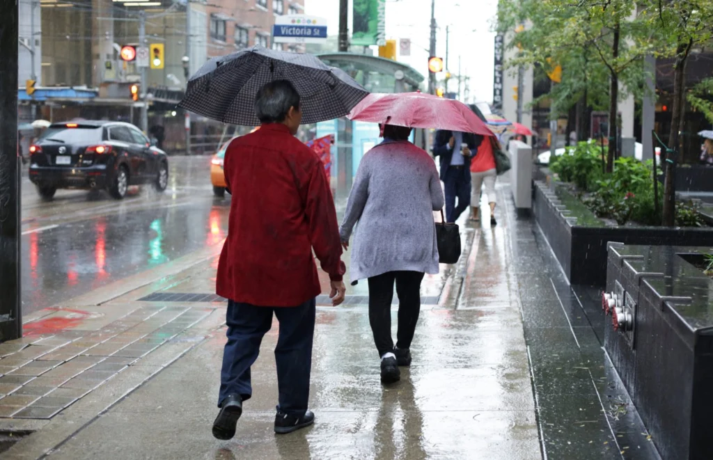
TORONTO — Toronto and the Greater Toronto Area (GTA) are preparing for a noticeable change in the weather over the coming days, as a cold air mass moves in, bringing lower temperatures and the possibility of rain mixed with snow after an unusually warm start to November.
Residents can expect cloudy, changeable conditions throughout the week, with a temporary rise in temperature on Tuesday, before temperatures begin to fall gradually, reaching zero during some overnight hours.
Environment and Climate Change Canada forecasts indicate a chance of light snow flurries from Thursday evening, but it does not necessarily expect a major snowstorm or widespread accumulation in the city.
Tuesday brings the last temporary warm spell
Monday's high could reach about 11 C, with heavy cloud and a chance of scattered rain, before falling to 5 C overnight.
On Tuesday, Nov. 10, temperatures are expected to rise temporarily to about 14 or 15 C, making it the warmest day of the coming period.
The conditions may come with wind gusts of up to 50 km/h, which calls for caution when travelling, especially in exposed areas.
The Meteorological Service of Canada expects cloud to continue on Tuesday, with the overnight low falling to 3 C and a chance of scattered rain returning.
Wednesday starts a gradual drop
On Wednesday, Nov. 11, temperatures fall to about 12 C during the day, as Canada marks Remembrance Day.
The forecast calls for a mix of cloud and limited brighter periods, with a 30 to 40 per cent chance of showers depending on the time of day and forecast updates.
Temperatures are expected to drop overnight as a colder air front approaches southern Ontario.
The intensity of rain and wind will vary between central Toronto and the northern and western suburbs, so residents are advised to follow forecasts for their own areas separately.
Thursday and Friday: possible rain and snow
Thursday, Nov. 12, is expected to see a clearer drop in temperatures, with a high of about 8 C according to the latest official forecasts and a 40 per cent chance of rain.
Overnight, temperatures fall to zero, which increases the chance that some of the rain will turn into a mix of rain and light snow.
Cold weather continues on Friday, Nov. 13, with a high of around 7 C and a 30 to 40 per cent chance of rain or snow showers.
The type of precipitation may differ by location and elevation, as areas north of Toronto could have a greater chance of seeing snow than areas near Lake Ontario.
A forecast of snow flurries does not necessarily mean snow will accumulate on roads or sidewalks.
Forecast temperatures in Toronto
According to Environment and Canada forecasts issued on Nov. 9, 2026 (daily highs and conditions):
- Monday, Nov. 9: 10°, mostly cloudy
- Tuesday, Nov. 10: 15°, cloudy and windy
- Wednesday, Nov. 11: 12°, chance of rain
- Thursday, Nov. 12: 8°, rain, with possible showers overnight
- Friday, Nov. 13: 7°, rain or light snow
- Saturday, Nov. 14: 8°, chance of scattered showers
- Sunday, Nov. 15: 9°, cloud and sunny periods
Warnings about frost and road conditions
Overnight temperatures near zero could lead to frost forming on some surfaces, especially in the suburbs and open areas.
Drivers are advised to take care on bridges and elevated roads, where road surface conditions can change quickly when moisture and cold coincide.
Residents are also advised to prepare winter clothing and check official updates before travelling in the morning, keeping in mind that forecasts are subject to change.
Has winter started early?
The shift comes after a warm spell in Toronto, with temperatures reaching about 18 C last Thursday, above the usual levels for early November.
The city's normal daily high for this period is about 8 to 9 C.
Meteorologists stress that the expected drop represents a gradual return to cold weather and is not in itself evidence of the start of a long winter cold spell.
The main expectations for the week remain a temporary rise on Tuesday, followed by a clear drop starting Thursday, with a chance of frost and light snow through the end of the week.
More from Hala Canada
- Young man sentenced to 5½ years in prison for shooting at Montreal Jewish school
- Budget 2026 omits pledge to double home building as Ottawa sets new non-market housing target
- Dunkin' returns to Canada after eight years; building permits reveal Toronto location
- Poll: most Toronto-area residents say their communities offer enough support to newcomers
- Toronto traveller faces possible 15-year prison term in Albania over baggage tag case
- China says it has no interest in interfering in Canada's affairs ahead of Carney-Xi meeting